Rheintalstadion, Vaduz
Rheintalstadion, Vaduz is a holding tank dump station in Vaduz, Liechtenstein. Rheintalstadion, Vaduz is situated close to the stadium Rheinparkstadion and the playground Kinderspielplatz.Notable Places in the Area
Rheinpark Stadion
Pitch

Photo: Wikimedia, CC BY-SA 3.0.
Rheinpark Stadion in Vaduz is the national stadium of Liechtenstein. Rheinpark Stadion is situated 120 metres north of Rheintalstadion, Vaduz.
Kunstmuseum Liechtenstein
Museum
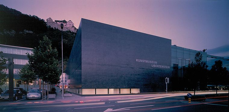
Photo: Wikimedia, CC BY-SA 3.0.
The Kunstmuseum Liechtenstein is a state art museum in Vaduz, Liechtenstein. Kunstmuseum Liechtenstein is situated 1 km east of Rheintalstadion, Vaduz.
Liechtenstein State Library
Library
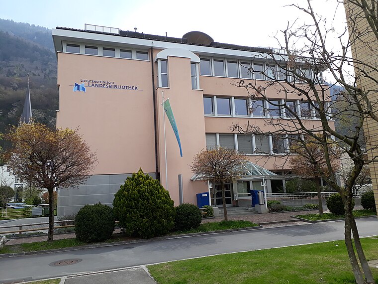 The Liechtensteinische Landesbibliothek is the legal deposit and copyright library for Liechtenstein. Liechtenstein State Library is situated 1 km southeast of Rheintalstadion, Vaduz.
Localities in the Area
Mühleholz
Village

Photo: Clemensoe, CC BY-SA 4.0.
Mühleholz is a village in Liechtenstein located in the municipality of Vaduz.
Rotenboden
Village
Rotenboden is a village of Liechtenstein, located in the municipality of Triesenberg. Rotenboden is situated 2½ km southeast of Rheintalstadion, Vaduz.
Rheintalstadion, Vaduz
- Type: Holding tank dump station
- Category: transportation
- Location: Vaduz, Liechtenstein, Central Europe, Europe
- View on OpenStreetMap
Latitude
47.13946° or 47° 8' 22" northLongitude
9.51041° or 9° 30' 38" eastOpen Location Code
8FVF4GQ6+Q5OpenStreetMap ID
node 8850402432OpenStreetMap Feature
amenity=sanitary_dump_stationRheintalstadion, Vaduz Satellite Map
© OpenStreetMap, Mapbox and Maxar
Landmarks in the Area
- RheinparkstadionStadium
- KinderspielplatzPlayground, 260 metres north
- Liechtenstein Institute of Professional Trustees and FiduciariesGovernment office, 660 metres northeast
Places in the Area
- Vaduz RheinparkstadionBus stop
Escape to a Random Place
Discover other holding tank dump stations in the world.
About Mapcarta. Thanks to Mapbox for providing amazing maps. Data © OpenStreetMap contributors and available under the Open Database License. Text is available under the CC BY-SA 4.0 license, excluding photos, directions and the map. Photo: Wikimedia, CC BY-SA 2.5.