There are many incredible state parklands in the United States, but Dead Horse Point State Park in Southern Utah might just be the most renowned. The park, which gets its name from a legend that cowboys used the peninsula of rock surrounded by sheer sandstone cliffs to corral wild mustangs.
According to the legend, horses were once left corralled on the waterless point where they died of thirst. If you believe the legend, these dead horses still haunt the park to this day.
What isn’t legend is that this breathtaking park continues to attract hundreds of thousands of visitors each year. It’s breathtaking landscape of canyons, high desert forest, and a seemingly endless number of incredible hiking and mountain biking trails will keep bringing you back for more.

This Guide Has Everything You Need to Plan Your Trip
In my Dead Horse Point State Park guide, I will provide you will all of the information that you will need to plan a fun and memorable trip to visit the park. I explain the best way for travelers to get to the park from outside the state or outside the country.
I also outline the best times to visit the park and highlight the top things to see and do while you are there. Finally, I also give you my suggestions on the best things to see and do outside of the park while on your trip. With this information in hand, it will be easy to plan a trip to Dead Horse Point State Park that you will remember for a lifetime.

How to Get to Dead Horse Point State Park

Dead Horse Point State Park is located in Southern Utah, roughly 40-minutes southwest of the city of Moab. Conveniently, this incredible state park is located right near the entrance to the Islands in the Sky District of the renowned Canyonlands National Park.
This makes seeing both parks in one day a relatively easy feet if you plan your time wisely. If you are visiting the park from outside of the state of Utah and plan on flying in for your visit to the Moab area, the closest major airport is the Salt Lake City International Airport (SLC).
However, if you are planning on seeing other parks and points of interest in the Southern Utah and Northern Arizona area during your visit, it may make sense to fly into the Las Vegas Harry Reid International Airport (LAS). This will allow you to take a long loop thru Southern Utah and Northern Arizona and wind up back in Las Vegas to fly home.
The park is also in very close proximity to several other national parklands, national monuments, Utah state parks, and other areas of interest as well. If you are starting to plan your visit to the park and would like to add some additional destinations to your itinerary, you are in luck. I have provided a table with the distance from the park to other points of parks and points of interest in the area for you to review below.
| Place | Driving Distance | Driving Time | Place | Driving Distance | Driving Time |
|---|---|---|---|---|---|
| Moab, UT | 40 miles | 37 min | Zebra Slot | 230 miles * | 4 hrs 16 min |
| Canyonlands NP | 20 miles | 29 min | Escalante, UT | 227 miles | 4 hrs |
| Arches NP | 27 miles | 32 min | Bryce Canyon NP | 283 miles | 4 hrs 25 min |
| Corona Arch | 40 miles | 1hr 25 min | Devil's Garden | 235 miles * | 4 hrs 30 min |
| Goblin Valley SP | 109 miles | 1hr 45 min | Antelope Canyon | 297 miles | 4 hrs 50 min |
| Leprechaun Slot | 145 miles | 2 hrs 15 min | Horseshoe Bend | 306 miles | 5 hrs |
| Capitol Reef NP | 165 miles | 2 hrs 45 min | Page, AZ | 303 miles | 5 hrs |
| Goosenecks SP | 156 miles | 2 hrs 45 min | Zion NP | 353 miles | 5 hrs 15 min |
| Valley of Gods | 153 miles | 3 hrs | Grand Canyon NP | 334 miles | 5 hrs 30 min |
| Monument Valley | 178 miles | 3 hrs 15 min | Reflection Canyon | 273 miles ** | 6 hrs 20 min |
| Long Canyon Slot | 211 miles | 3 hrs 50 min | Las Vegas, NV | 366 miles | 6 hrs 45 min |
| Salt Lake City, UT | 243 miles | 3 hrs 55 min |
Table Legend
| NP = National Park |
| SP = State Park |
| SLOT = Slot Canyon |
| * = Requires drivig on an unimproved road |
| ** = Requires a high-clearance 4WD vehicle to reach |
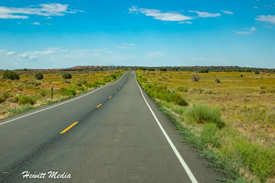
Directions to Dead Horse Point State Park
Dead Horse Point State Park is located just outside of the Islands in the Sky District of Canyonlands National Park near the city of Moab in Southern Utah. If you are planning to be in the area to see Canyonlands and Arches National Park, the state park is an excellent add-on site to see. If you are planning on visiting Dead Horse Point from Moab or one of the other adventure hubs in the area, I have included driving directions for you below.
Directions from Moab, Utah
If visiting the park from the city of Moab, please follow these directions to get to the park:
- Head North out of Moab on US-191 N/N Main St.
- Continue on US-191 N/N Main St for 11 miles.
- Turn left onto UT-313 W.
- Continue on UT-313 W for 14.6 miles.
- Turn left to stay on UT-313 W.
- Continue on UT-313 W for 5.3 miles.
- The park will be on your left-hand side.
Directions from Escalante, Utah
If visiting the park from the city of Escalante, please follow these directions to get to the park:
- Head east on UT-12 E.
- Continue on UT-12 E for 63.6 miles.
- Turn right onto UT-24 E.
- Continue on UT-24 E for 47 miles.
- Turn left to stay on UT-24 E.
- Continue on UT-24 E for 43.3 miles.
- Merge onto I-70 E via the ramp to Green River.
- Stay on I-70 E for 32.2 miles.
- Take exit 182 toward Moab.
- Merge onto US-191 S.
- Continue on US-191 S for 20.3 miles.
- Turn right onto UT-313 W.
- Continue on UT-313 W for 14.6 miles.
- Turn left to stay on UT-313 W.
- Continue on UT-313 W for 5.3 miles.
- The park will be on your left-hand side.
Directions from Page, Arizona
If visiting the park from the city of Escalante, please follow these directions to get to the park (please note that Page, AZ and Dead Horse Point State Park are in different time zones):
- Head South out of Page on Coppermine Rd.
- After about 1.4 miles, turn left onto AZ-98 E.
- Continue on AZ-98 E for 64.2 miles.
- Turn left onto US-160 E.
- Continue on US-160 E for 75.4 miles.
- Turn left onto US-191 N (signs for VA-12).
- Continue on US-191 N for 26.5 miles. You will enter Utah.
- Turn right to stay on US-191 N.
- Continue on US-191 N for 30.1 miles.
- Turn right onto E Center St.
- E Center St. turns into US-191 N/N Grayson Pkwy.
- Continue on US-191 N/N Grayson Pkwy for 70.9 miles.
- Continue straight to stay on US-191 N for another 14.5 miles.
- Turn left onto UT-313 W.
- Continue on UT-313 W for 14.6 miles.
- Turn left to stay on UT-313 W.
- Stay on UT-313 W for an additional 5.3 miles.
- The park will be on your left-hand side.
Top Things to See and Do in Dead Horse Point

If one thing is for certain, it is that Dead Horse Canyon State Park is not lacking in beautiful vistas. There are a number of jaw-dropping viewpoints in which you can view this stunning park. In addition to the views, there are also miles-and-miles of hiking and biking trails for visitors to enjoy.
If you like to be active when you travel, you will love this state park. If you are starting to plan your trip and would like some suggestions on what to see, I have you covered. I have included my picks for the top things to see and do in Dead Horse Point State Park for you to review below.
Big Horn Overlook

One of the first overlooks that you will encounter when you enter Dead Horse Point State Park is the incredible Big Horn Overlook. This overlook has some incredible views and is really pretty at sunrise. In order to get to the viewpoint, you will have to take a short hike.
Map of the Big Horn Overlook
Big Horn Overlook Hiking Trail Map
The trail is roughly 3-miles out-and-back and is generally considered to be easy. The trail is open year-round, so it can be hiked at any time. If you do bring your dog with you on the hike, please know that dogs must be leashed at all times. For more information on this hike, please refer to the map I included from Alltrails below.
Rim Overlook

The second lookout that you will encounter after entering the park is the breathtaking Rim Overlook. The Rim Overlook Trail is accessible via the west side of the Rim Trail within the park.
The entire West Rim Trail is roughly 3.5-miles one way, but you can access the Rim Overlook by accessing the trail from the Kayenta Campground and hiking from there. For more information on the Rim Trail and hiking in the park, please see the hiking section of this guide.
Map of the Rim Overlook
Colorado River Overlook

The Colorado River Overlook is one of the most accessible overlooks in the park. There is a parking area located off the main park road and a short 1-mile (round trip) hike from the parking area up to the viewpoint.
The views from this viewpoint are absolutely breathtaking as you get your first glimpses of the Colorado River, which carved the canyon over thousands of years. This overlook is spectacular to visit at sunset.
Map of the Colorado River Overlook
Meander Overlook

The Meander Overlook is another viewpoint that can be accessed via the West Rim Trail. The best place to start the hike to this viewpoint is from the Wingate Campground. For more information on the Rim Trail and hiking in the park, please see the hiking section of this guide.
From this viewpoint, you can see the point where the Colorado River meanders to make a turn thru the canyon. Outside of Dead Horse Point, this is one of my favorite viewpoints within the park because of the incredible views.
Map of the Meander Overlook
Basin Overlook

The Basin Overlook is located on the East side of the canyon and can be accessed via the East Rim Trail. The best place to start the hike to this viewpoint is from the Kayenta Campground. For more information on the Rim Trail and hiking in the park, please see the hiking section of this guide.
The East Rim Trail is generally considered to be easier than the West Rim Trail, so this viewpoint is one of the easier viewpoints to reach in the park. From here, you have some breathtaking views of the canyon and the vastness of this landscape.
Map of the Basin Overlook
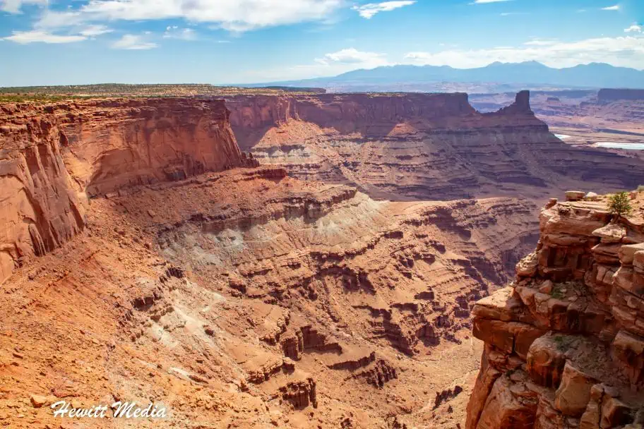
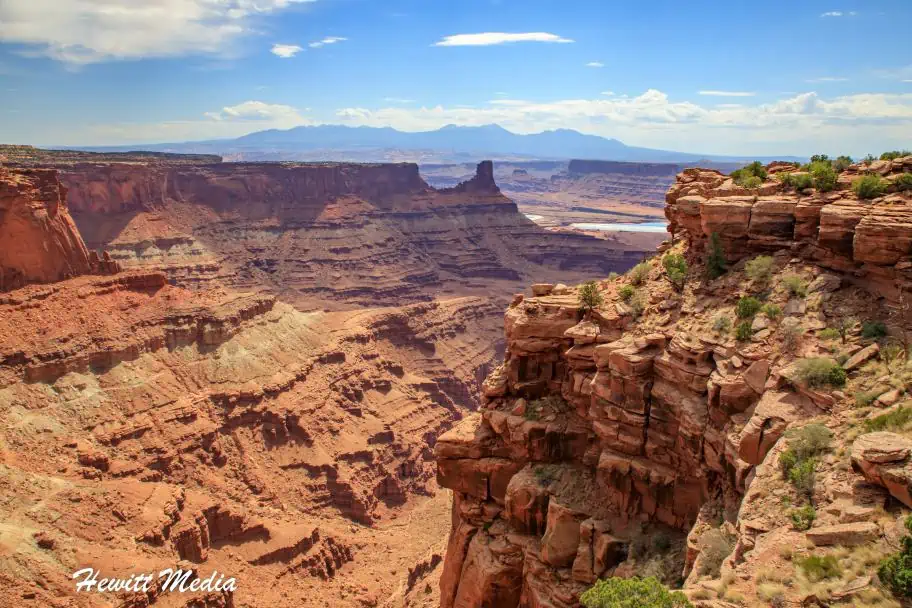
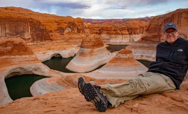
Dead Horse Point Overlook
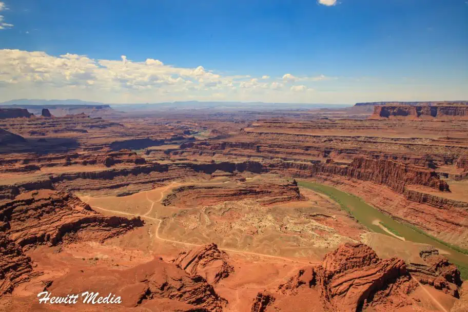
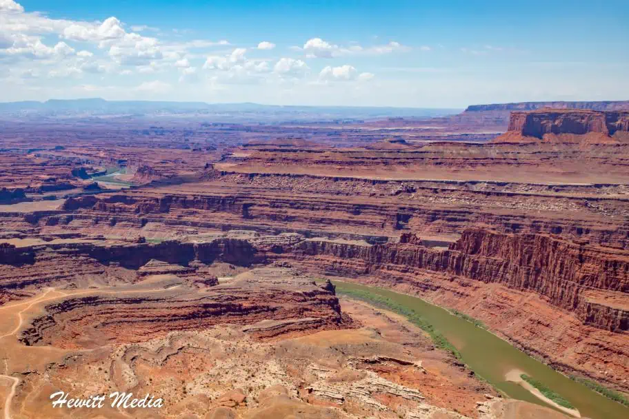
If there is only one viewpoint you see in the park, I recommend making that viewpoint the Dead Horse Point viewpoint. The views of the breathtaking canyon and the expanse of canyons off into the distance is simply breathtaking.
This is also one of the most easily accessible viewpoints within the park. From the overlook parking lot, a short hike on a paved pathway leads to breathtaking views of the Colorado River some 2,000 feet below. You will be left speechless by the beauty of what you are seeing.
Map of the Dead Horse Point Overlook
Hiking in Dead Horse Point State Park

One of the most popular activities in the park is hiking on the park’s incredible hiking trails. The Dead Horse Point State Park has many breathtaking viewpoints that are accessible via a loop hiking trail that follows the contours of the canyon. This looped trail is broken down into the East Rim Trail (which sits on the East side of the park) and the West Rim Trail (on the West side of the park).
The West Rim Trail
The West Rim Trail is generally considered to have more primitive hiking trails and is considered more difficult than the East Rim Trail. Hiking the West Rim Trail requires a hike of roughly 3.5-miles (one-way) on moderately difficult terrain. When hiking, make sure to follow the cairn-marked routes over exposed sections of sandstone and slick rock. The overlooks accessible via this trail include:
- The Big Horn Overlook
- The Rim Overlook
- The Schafer Canyon Overlook
East Rim Trail
The East Rim Trail is considered to be much easier to hike than the West side.
The trail begins at the visitor center and follows the eastern side of the mesa to Dead Horse Point. Hiking this side of the trail is a popular alternative to just driving the main park road. If you have the time, I absolutely recommend it. From the trail, you have spectacular views of the La Sal Mountains.
The entire East Rim Trail is roughly 1.5 miles between the visitor center and Dead Horse Point. If you would like to see the Basin Overlook viewpoint, it is an additional 0.5 miles off the trail.
Rim Trail Loop Map
If you would like to hike the entirety of the Rim Loop Trail in Dead Horse Point State Park, it is a roughly 8-mile loop that will take you at least 3.5-hours to complete. You can make a stop at the Visitor Center to grab some refreshments and use this stop to take a break from the heat. For more information on this loop trail, please see the map I included from Alltrails below.
Camping Under the Stars in Dead Horse Point State Park

Because of the remoteness of the area, the skies around the park are some of the darkest skies that you will find anywhere in North America. This means that the area is one of the best places to do star gazing at night.
If you are planning to visit the Moab area and will be visiting the Dead Horse Point State Park, I recommend considering camping out at the park. It is a great way to appreciate the beauty of the night sky and also see some of the breathtaking sunrises and sunsets that the area gets.
For more information on campgrounds, please see the Where to Stay Near Dead Horse Point State Park section of this guide.
Mountain Biking in Dead Horse Point State Park

Travelers who love to mountain bike will absolutely love visiting the Dead Horse Point State Park. The park is renowned for its amazing biking trails and even has bikes available for visitors to rent.
There are miles of extraordinary trails for you to explore within the park, with incredible desert landscape as a stunning background. One of the most popular trails to explore within the park is the acclaimed Intrepid Mountain Biking Trail.
The trail winds thru beautiful juniper and pinyon trees over slick rock terrain with spectacular views of the canyon. All total, the trail includes 16.6-miles of non-motorized singletrack trail for you to explore.
If you don’t have a bike with you, it’s no problem. Bikes can be rented near the Moenkopi Yurts near the park entrance from Bighorn Mountain Biking.
Intrepid Mountain Biking Trailhead Map
Sleeping in a Yurt in Dead Horse Point State Park

If you would like to experience the beautiful skies around the park at night, but aren’t quite up for camping out, there is a perfect middle ground for you to explore. One of the coolest experiences you can have at Dead Horse Point State Park is staying overnight in a yurt.
There are two different sites within the park with yurts, the Moenkopi Yurts and the Wingate Yurts areas. Each site is equipped with yurts that have the sleeping space for up to six people, including a bunk bed and a pullout futon couch. Pets are also allowed in the park but must be on a leash when outside of the yurts.
All the yurts are supplied with modern restroom facilities, as well as heating, air-conditioning, and eletric outlets for charging your electronic devices. In addition, you will find a propane grill on the deck of each yurt, with propane supplied by the park. It is a perfect way to experience the beauty of the park with the conveniences of a hotel, without having to leave the park.
Moenkopi Yurts Map
Wingate Yurts Map
Dead Horse Point State Park Resources

As you start to plan your trip to the park, you are going to probably have questions on what times things open, what fees are charged, and where to find certain things. In order to make your planning process as stressless as possible, I have provided links to download a detailed park map and the park brochure above. I have also provided links to resources on the state park website for you to conveniently access below.
- Intrepid Mountain Biking Trail
- Dead Horse Point Rim Hiking Trails
- Traveling with Pets
- Kayenta Campground
- Wingate Campground
- Moenkopi Yurts
- Mountain Bike Rentals
- Drone Regulations
When to Visit Dead Horse Point State Park

While being located in the American Southwest may lead you to believe the weather in the Moab, Utah area is hot year-round, that can be misleading. This area is located on a high desert plateau, so its high elevation creates much more variation in the weather than you’d expect.
If you are in the process of starting to plan your trip to the Moab area, I have included some key weather information for you to review below. This information will help you plan your trip for the time of year that best suits your needs.
Average Temperature (°F)
Because of its higher elevation, the disparity in the average temperature from winter to summer is much higher than other parts of North America. During the hot summer months of June thru August, temperatures can exceed 110 degrees Fahrenheit.
Meanwhile, during the winter months of December thru February, it isn’t uncommon to see it get cold enough to snow. If you ask me, the best times of the year to visit the Moab area are during the late spring or early autumn months. Between April and May and September and October the temperatures are typically perfect for hiking, biking, and camping.
Average Precipitation (Inches)
The Moab, Utah area doesn’t see a whole lot of rain throughout the year, which is why it is technically classified as a desert area. However, even the small amount of rain the area does get can result in dangerous flash floods in the slot canyons and wash out the unimproved roads.
This can make exploring the beauty of the Moab area much more difficult. If possible, I would suggest visiting during the spring months of April and May as those months tend to be drier than the autumn months of September and October.
Other Things to See in the Area

There are few areas in North America that are as stunning as the American Southwest. This canyon-filled area has a seemingly endless supply of breathtaking vistas, incredible slot canyons, and gorgeous rock formations.
If you are planning a trip to the Moab, Utah area to see Dead Horse Canyon State Park, there is a wealth of other things for you to see in the area as well. In this section of my guide, I outline some of the other top spots in the area that I would make sure you don’t miss.
Canyonlands National Park

Canyonlands National Park is one of America’s most popular national parks. It is renowned for its spectacular canyon viewpoints and its incredible backcountry hiking and canyoneering. It is an absolute must-see park if you are in the Moab area. And because of its close proximity to Dead Horse Point, it is easy to see both in one visit.
However, if you want to see all that Canyonlands has to offer, you are going to need to spend multiple days in the park. The park is split into three districts, with each district offering a different type of landscape and experience for the visitor. For more information on how to visit Canyonlands and what to see, please check out my Canyonlands National Park guide linked below.
| READ MORE: |
 |
| Canyonlands National Park Visitor Guide |
Arches National Park

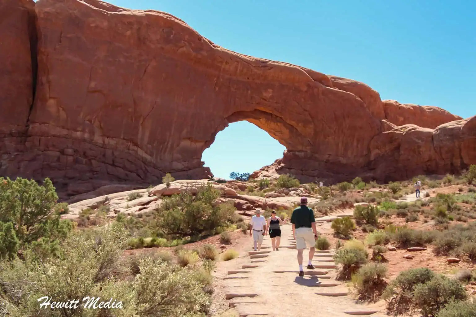
With over 2,000 natural sandstone arches within its confines, Arches National Park is unlike any other national park in America. This red rock wonderland features a variety of incredible arches and rock formations that will leave you in amazement. Double Arch South, which is the tallest in the park, is a staggering 112 feet (34.1 meters) high.
The widest arch, the beautiful Landscape Arch, stretches for over 306 feet (93.3 meters) across. However, the most popular arch in the park is undoubtedly the beautiful Delicate Arch. This breathtaking arch is so pretty that it is featured on the official license plate of the state of Utah. For more information on how to visit this amazing park, please see my Arches National Park guide below.
| READ MORE: | |
 | |
| Arches National Park Visitor Guide |
Goblin Valley State Park

One thing that Southern Utah is certainly not in short supply of is incredible landscapes. The southern half of the state is littered with parks and conservation areas that showcase the beauty of the area. Although it is a state park and not a national park, the amazing Goblin Valley State Park is one of the area’s prettiest parks.
Known for its unique and beautiful rock spires that stick up out of the valley floor like a horde of goblins, the park is certain to wow even the hardest to please visitors. In addition to having many great viewpoints and hiking trails, the park is also great for camping. More information on how to visit this wonderful park, please see my Goblin Valley visitor guide below.
| READ MORE: |
 |
| Ultimate Goblin Valley State Park Guide |
Corona Arch

While the arches in Arches National Park may get most of the glory, that doesn’t mean it holds all of the area’s pretty rock arches. In fact, one of the prettiest arches in the Moab area actually sits outside of the national parkland. Located just a short drive from the city, the Corona Arch is one of the largest and most impressive sandstone arches in the area.
It requires a moderate hike to get to, but the trail really isn’t difficult. If you have a few hours to spare between seeing the area’s parklands, I recommend checking out the Corona Arch. For information on this hike, please see the guide I linked to below.
| READ MORE: |
 |
| The Ultimate Corona Arch Trail Hiking Guide |
Leprechaun Canyon

One cannot visit Southern Utah without seeing one of the area’s beautiful slot canyons. The Page, Arizona and Grand Staircase-Escalante National Monument have some of the American Southwest’s most renowned slot canyons. However, these canyons are often either incredible busy or difficult to get to. For those who will be in the Moab, Utah area and would like to see a slot canyon, the amazing Leprechaun Canyon is not far away.
The best part is, this canyon is far less well-known than some of its more popular counterparts in the Southwest, so you don’t need to battle crowds to see it. It is also fairly easy to get to, so it’s accessible to hikers of all skill levels. For more information on the incredible Leprechaun slot canyon, please see my visitor guide linked below.
| READ MORE: |
 |
| Leprechaun Canyon Trail Guide |
Where to Stay Near Dead Horse Point State Park

Campgrounds
When visiting the national parks, monuments, and other areas of interest in the United States, it is a really neat experience to camp out. Some of the best campgrounds in America can be found inside the country’s national parks, monuments, recreation areas, and surrounding areas.
This is especially true in Southern Utah. The extra dark skies in the area make it a great place to stargaze. If you are interested in camping out during your visit, I have included a map of campgrounds in the area for you to review in my guide below.
Hotels
If camping is not your speed, you need not worry as there are a variety of good hotels for you to choose from in the area as well. In fact, the incredible town of Moab, Utah is just a short drive from the park and is a perfect place to book a hotel for your visit.
If you are in the process of planning your trip to Southern Utah, then you are in luck. I have included a map and list of recommended hotels at different price points for you to review in my guide below.

Activities in the Moab, Utah Area

There are a lot of beautiful and amazing things to see in Southern Utah, but there are also a lot of really fun activities as well. If you are starting to plan your trip and are looking for some fun activities to enjoy while you are in the Moab area, I have included some suggestions for you to review in my guide below.
 |
Hiking Trails |
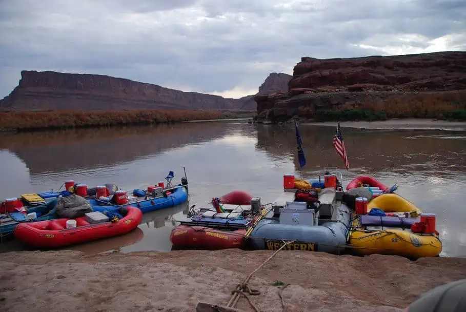 |
White Water Rafting |
 |
Nature and Parks |
 |
Mountain Bike Tours |
 |
4WD Tours |
 |
Climbing |
 |
Nature and Wildlife |
Dead Horse Point State Park Photo Gallery
It is no coincidence that Dead Horse Point State Park is one of the most renowned state parks in the United States. There seems to be a breathtaking view around every corner. If you would like to see some more of my pictures from the park, I have included a gallery for you to review below.
If you would like to see more of my travel photography, I would also encourage you to give me a follow on Instagram. Putting this blog together to pass on my free guides, itineraries, and travel photography tips is a lot of work and your support in the form of a follow-on Instagram would be so very much appreciated!
FOLLOW ME!


Don’t Forget to Subscribe to My Adventures!

Let Me Help You Save On Your Next Adventure!
‘Start Exploring Today’ Merchandise Available Now!
 |
 |
 |
 |
 |
 |
 |


1 comment ›